Audio Tour
San Francisco to Los Angeles
382miles
29stops
5h53m
Listen — all 29 stops free
1
San Francisco City Hall Rebuilt After 1906
Mile 0 — San Francisco
San Francisco City Hall is one of the largest domed structures in the United States.
0:00
2
Bay Bridge Engineering and Yerba Buena Island
Mile 4 — San Francisco
You're crossing the San Francisco-Oakland Bay Bridge, and the eastern span you're on is an engineering landmark.
0:00
3
Oakland Hills Firestorm Changed Everything
Mile 11 — Oakland
On October 20, 1991, a grass fire that had been incompletely extinguished the day before reignited in the hills to the east of where you are now.
0:00
4
Oakland Coliseum and Multi-Sport Era
Mile 15 — Oakland
The Oakland-Alameda County Coliseum complex you can spot near here is one of the last multi-sport venue sites built in the 1960s.
0:00
5
Castro Valley's Card Game Origins
Mile 26 — Hayward
Castro Valley is named after Don Guillermo Castro, a Californio ranchero who reportedly won this land in a card game in the 1840s.
0:00
6
Camp Parks and Wartime Pleasanton
Mile 36 — Pleasanton
During World War Two, this stretch of Pleasanton housed two massive military installations that processed hundreds of thousands of troops.
0:00
7
Lawrence Livermore National Laboratory Fusion Breakthrough
Mile 45 — Livermore
You're passing near Lawrence Livermore National Laboratory, where in December 2022 scientists achieved something physicists had chased for over sixty years — the first…
0:00
8
Altamont Pass Wind Farm Controversy
Mile 50 — Livermore
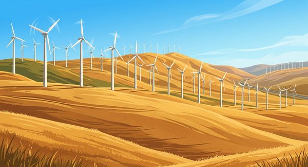
The Altamont Pass wind farm you're driving through was one of the first large-scale wind energy installations on Earth.
0:00
9
Tracy Railroad Junction and Valley Gateway
Mile 59 — Tracy
Tracy has been a critical railroad junction since the Central Pacific laid tracks here in 1869.
0:00
10
California Aqueduct and the Water Wars
Mile 59 — Tracy
You're crossing the California Aqueduct right now. Watch for the wide, concrete-lined canal passing beneath the highway.
0:00
11
The Diablo Range Rain Shadow Effect
Mile 64
You're driving through one of California's sharpest climate transitions.
0:00
12
Entering the Central Valley Floor
Mile 70 — Tracy
You're now at the junction of I-5 and I-580, one of the most heavily congested interchanges in Northern California.
0:00
13
Newman and the West Side Cotton Legacy
Mile 90
You're passing through the Newman area, a stretch of the west side of the San Joaquin Valley that was once one of California's major cotton-producing regions.
0:00
14
O'Neill Forebay: Where Two Systems Merge
Mile 110 — Gustine
The reservoir you're passing is O'Neill Forebay, and it holds a distinction in American water engineering.
0:00
15
Los Banos and the Grasslands Wetland Basin
Mile 119
Los Banos takes its name from a Spanish phrase meaning the baths, referring to a creek where early Spanish soldiers from the nearby San Juan Bautista mission would stop…
0:00
16
Firebaugh and Andersen's Pea Soup Legacy
Mile 129 — Firebaugh
Firebaugh started as a ferry crossing on the San Joaquin River, established by Andrew Firebaugh during the Gold Rush in 1854.
0:00
17
Kettleman City and Environmental Justice Battles
Mile 129 — Firebaugh
Kettleman City, just ahead to the southwest, became a national flashpoint for environmental justice in the early 1990s.
0:00
18
Mendota: The Cantaloupe Capital Drying Out
Mile 155
Mendota calls itself the cantaloupe capital of the world, but the town tells a harder story about California agriculture.
0:00
19
Harris Ranch and the Coalinga Feedlot
Mile 181 — Coalinga
That unmistakable smell means you're passing Harris Ranch, the largest beef cattle operation on the West Coast.
0:00
20
Coalinga Oil Field Since 1887
Mile 188 — Coalinga
Those bobbing pumpjacks in the hills to the west are pulling crude from the Coalinga oil field, one of California's oldest.
0:00
21
Kettleman Hills Geology Beneath the Surface
Mile 214
The low ridgeline to the west is the Kettleman Hills, one of the most studied geological formations in California.
0:00
22
Lost Hills and the Water Empire
Mile 239 — Lost Hills
Lost Hills is essentially a company town.
0:00
23
Kern County's Underground Oil Basin
Mile 248
You're driving through the southern San Joaquin Valley across one of the most oil-rich basins in the United States.
0:00
24
Buttonwillow and Its Lone Landmark Tree
Mile 258 — Buttonwillow
Buttonwillow gets its name from a single buttonwillow tree that stood alone on the flat valley floor, so distinctive that the Yokuts people used it as a meeting place…
0:00
25
The Grapevine Climb Through Tejon Pass
Mile 268 — Bakersfield
You're approaching the Grapevine, one of the most consequential stretches of highway in America.
0:00
26
The Southern San Joaquin Valley Floor
Mile 287
You're crossing one of the most productive agricultural zones on Earth.
0:00
27
Fort Tejon and the Army Camel Corps
Mile 306 — Lebec
Fort Tejon, just off the interstate here, was where the United States Army tested camels as military transport animals.
0:00
28
Peter Lebeck and the Old Oak Tree
Mile 309 — Lebec
In 1853, someone discovered carved into the bark of a large valley oak tree near here a brief inscription: Peter Lebeck, October 17, 1837.
0:00
29
Dropping Into the Santa Clarita Valley
Mile 345
You're descending through the Newhall Pass area, one of the most geologically active corridors in Southern California.
0:00
iOS · Works offline · Hands-free
Listen — all 29 stops free
1
San Francisco City Hall Rebuilt After 1906
Mile 0 — San Francisco
San Francisco City Hall is one of the largest domed structures in the United States.
0:00
2
Bay Bridge Engineering and Yerba Buena Island
Mile 4 — San Francisco
You're crossing the San Francisco-Oakland Bay Bridge, and the eastern span you're on is an engineering landmark.
0:00
3
Oakland Hills Firestorm Changed Everything
Mile 11 — Oakland
On October 20, 1991, a grass fire that had been incompletely extinguished the day before reignited in the hills to the east of where you are now.
0:00
4
Oakland Coliseum and Multi-Sport Era
Mile 15 — Oakland
The Oakland-Alameda County Coliseum complex you can spot near here is one of the last multi-sport venue sites built in the 1960s.
0:00
5
Castro Valley's Card Game Origins
Mile 26 — Hayward
Castro Valley is named after Don Guillermo Castro, a Californio ranchero who reportedly won this land in a card game in the 1840s.
0:00
6
Camp Parks and Wartime Pleasanton
Mile 36 — Pleasanton
During World War Two, this stretch of Pleasanton housed two massive military installations that processed hundreds of thousands of troops.
0:00
7
Lawrence Livermore National Laboratory Fusion Breakthrough
Mile 45 — Livermore
You're passing near Lawrence Livermore National Laboratory, where in December 2022 scientists achieved something physicists had chased for over sixty years — the first…
0:00
8
Altamont Pass Wind Farm Controversy
Mile 50 — Livermore
The Altamont Pass wind farm you're driving through was one of the first large-scale wind energy installations on Earth.
0:00
9
Tracy Railroad Junction and Valley Gateway
Mile 59 — Tracy
Tracy has been a critical railroad junction since the Central Pacific laid tracks here in 1869.
0:00
10
California Aqueduct and the Water Wars
Mile 59 — Tracy
You're crossing the California Aqueduct right now. Watch for the wide, concrete-lined canal passing beneath the highway.
0:00
11
The Diablo Range Rain Shadow Effect
Mile 64
You're driving through one of California's sharpest climate transitions.
0:00
12
Entering the Central Valley Floor
Mile 70 — Tracy
You're now at the junction of I-5 and I-580, one of the most heavily congested interchanges in Northern California.
0:00
13
Newman and the West Side Cotton Legacy
Mile 90
You're passing through the Newman area, a stretch of the west side of the San Joaquin Valley that was once one of California's major cotton-producing regions.
0:00
14
O'Neill Forebay: Where Two Systems Merge
Mile 110 — Gustine
The reservoir you're passing is O'Neill Forebay, and it holds a distinction in American water engineering.
0:00
15
Los Banos and the Grasslands Wetland Basin
Mile 119
Los Banos takes its name from a Spanish phrase meaning the baths, referring to a creek where early Spanish soldiers from the nearby San Juan Bautista mission would stop…
0:00
16
Firebaugh and Andersen's Pea Soup Legacy
Mile 129 — Firebaugh
Firebaugh started as a ferry crossing on the San Joaquin River, established by Andrew Firebaugh during the Gold Rush in 1854.
0:00
17
Kettleman City and Environmental Justice Battles
Mile 129 — Firebaugh
Kettleman City, just ahead to the southwest, became a national flashpoint for environmental justice in the early 1990s.
0:00
18
Mendota: The Cantaloupe Capital Drying Out
Mile 155
Mendota calls itself the cantaloupe capital of the world, but the town tells a harder story about California agriculture.
0:00
19
Harris Ranch and the Coalinga Feedlot
Mile 181 — Coalinga
That unmistakable smell means you're passing Harris Ranch, the largest beef cattle operation on the West Coast.
0:00
20
Coalinga Oil Field Since 1887
Mile 188 — Coalinga
Those bobbing pumpjacks in the hills to the west are pulling crude from the Coalinga oil field, one of California's oldest.
0:00
21
Kettleman Hills Geology Beneath the Surface
Mile 214
The low ridgeline to the west is the Kettleman Hills, one of the most studied geological formations in California.
0:00
22
Lost Hills and the Water Empire
Mile 239 — Lost Hills
Lost Hills is essentially a company town.
0:00
23
Kern County's Underground Oil Basin
Mile 248
You're driving through the southern San Joaquin Valley across one of the most oil-rich basins in the United States.
0:00
24
Buttonwillow and Its Lone Landmark Tree
Mile 258 — Buttonwillow
Buttonwillow gets its name from a single buttonwillow tree that stood alone on the flat valley floor, so distinctive that the Yokuts people used it as a meeting place…
0:00
25
The Grapevine Climb Through Tejon Pass
Mile 268 — Bakersfield
You're approaching the Grapevine, one of the most consequential stretches of highway in America.
0:00
26
The Southern San Joaquin Valley Floor
Mile 287
You're crossing one of the most productive agricultural zones on Earth.
0:00
27
Fort Tejon and the Army Camel Corps
Mile 306 — Lebec
Fort Tejon, just off the interstate here, was where the United States Army tested camels as military transport animals.
0:00
28
Peter Lebeck and the Old Oak Tree
Mile 309 — Lebec
In 1853, someone discovered carved into the bark of a large valley oak tree near here a brief inscription: Peter Lebeck, October 17, 1837.
0:00
29
Dropping Into the Santa Clarita Valley
Mile 345
You're descending through the Newhall Pass area, one of the most geologically active corridors in Southern California.
0:00